📜 LEGEND · EXP. Nº3657
ACTIVE
Zerzura, the Lost Oasis City
Zerzura is a lost oasis nobody has ever found, and its paper trail is shorter and stranger than the legend suggests.
Where does the legend of Zerzura, the Lost Oasis City come from?
- Location
- Western Desert / Gilf Kebir, Egypt
- Kind of legend
- Lost treasure
- Coordinates
- 23.75, 25.83
- Last updated
LOCATION
What is the legend of Zerzura, the Lost Oasis City?
The name first appears around 1246, in a list of villages already abandoned in the Fayyum drawn up by the province's Ayyubid administrator: a deserted hamlet in the Nile valley, not a desert oasis at all. The white city with a bird carved over its door comes from a different and later book, paragraph 369 of an anonymous fifteenth-century Egyptian treasure manual printed in Cairo in 1907, where the entry is headed the city of Warde, the city is white as a pigeon, and the instruction is to take the key from the bird's beak and carry off the treasure. The desert oasis is later still: in 1835 John Gardner Wilkinson printed a rumour collected in the oases, palms and springs and ruins of uncertain date, found by an Arab looking for a stray camel, and in his 1843 edition added a parenthesis calling the camel the usual reason given for all such voyages, real or fictitious. Between 1930 and 1934 British and Hungarian motorists turned that rumour into three real valleys in the Gilf Kebir, which the herdsmen of Kufra had been grazing all along.
What is the history of Zerzura, the Lost Oasis City?
Zerzura has a paper trail, and it is not the one the legend advertises. Three separate documents lie behind it, written centuries apart and about three different things, and somewhere on the way to us they were fused into one.
The oldest is a tax survey. Around 1246 Osman al-Nabulsi, a Syrian emir appointed by the Ayyubid sultan Najm al-Din to administer the Fayyum, listed the province's villages. Among those already abandoned in his day was one called Zarzura, standing in the list between Qasr Qarun and al-Rayan, on a canal called the Bahr Tanabtawayh. That is the whole of it: a deserted hamlet somewhere north of the Wadi Rayan, in a green province a few hours from Cairo and hundreds of kilometres from any desert anybody has ever searched. His text survives in a copy made in 1447 and was printed in Cairo in 1899.
The white city belongs to a different book, roughly two centuries younger. An anonymous fifteenth-century Egyptian treasure manual, whose Arabic title is Kitab al-durr al-maknuz but which desert explorers called the Kitab al-Kanuz or Book of Hidden Pearls, catalogues some four hundred sites in Egypt where riches were said to lie buried, most of them guarded by jinn and reachable only through incantations and fumigations. Ahmed Bey Kamal published the Arabic text with a French translation in Cairo in 1907; Gaston Maspero authorised the edition in the hope that a book obtainable for a few francs would stop being treated as a treasure map, because, as Kamal wrote in his introduction, it had done more damage to Egypt's monuments than war and time together. Its paragraph 369 is headed not Zerzura but "the city of Warde" in Kamal's French and "Wardabaha" in the Arabic volume. John Ball printed it in English in 1928. It opens: "In the city of Wardabaha, situated behind the citadel of el Suri, you will see palms, vines, and springs." The seeker is sent up a wadi and along a second one "running westwards between two mountains", from which a road leads "to the city of Zerzura, of which you will find the door closed; this city is white like a pigeon, and on the door of it is carved a bird." Then: "Take with your hand the key in the beak of the bird, then open the door of the city." And last: "Enter, and there you will find great riches, also the king and queen sleeping in their castle. Do not approach them, but take the treasure." The French translation prints the city's name as "Farzourah", which Ball called evidently a misprint, since the Arabic volume clearly reads Zerzura. That single paragraph is the source of the door, the carved bird, the key in the beak and the sleeping royal couple. It calls the city white. It does not say brass.
The desert oasis is later still, and comes from a different mouth. In 1835 the Egyptologist John Gardner Wilkinson printed a rumour he had collected in the oases: five or six days west of the road to Farafra lay another oasis, Wadee Zerzoora, "abounding in palms, with springs, and some ruins of uncertain date", found about nine years earlier by an Arab looking for a stray camel who took it to be inhabited because he saw the footprints of men and sheep. When Wilkinson reprinted the passage in 1843 he added a parenthesis: the stray camel was "the usual reason assigned for all these real or fictitious voyages". The man who gave Europe Zerzura had flagged its founding anecdote as a stock formula, and the parenthesis is almost never quoted.
The strands met in print between 1925 and 1930. W. J. Harding King pointed to the fifteenth-century manuscript; John Ball, of the Egyptian Survey, went looking for it, found al-Nabulsi behind it, printed paragraph 369 in the Geographical Journal in 1928 and concluded that Zerzura was a treasure story that had grown an oasis. In January 1930 the Journal opened a whole section titled "The Zerzura Problem", and in it E. A. Johnson Pasha, who owned the manuscript and had lent it to the Department of Antiquities around 1905, answered that the entry follows a description of Deir al-Qalamun in Dakhla and therefore points somewhere within reach of Dakhla. A deserted village on the edge of the Fayyum as the source of the tradition was, in his words, "more like poking fun than serious discussion".
Then the motorists arrived. Ralph Bagnold and five companions founded the Zerzura Club on 5 November 1930 in the Greek Bar at Wadi Halfa, and dined once a year in London until 1939. In 1932 Laszlo Almasy, Sir Robert Clayton-East-Clayton, Patrick Clayton and Squadron Leader Penderel flew over the northern Gilf Kebir and photographed a valley full of trees they could neither land in nor find the way into. A second expedition left Cairo on 14 March 1933 with Almasy, the writer Richard Bermann, the Budapest geographer Laszlo Kadar and the photographer Hans Casparius. At Kufra an old guide called Ibrahim named the valleys for them: Wadi Abd el Melik and Wadi Talh, and only later, grinning, a third, Wadi Hamra. They drove into Wadi Abd el Melik on 3 May 1933 and found hundreds of acacias, two rock springs reduced to a few drops of moisture, the remains of Tebu grass huts, camel dung, tracks of Barbary sheep and small birds of a species they did not know. Almasy climbed the escarpment on 5 May and saw Wadi Talh. At Ain Dua, Ibrahim admitted that the cow skeleton they had found on the path up was his own, lost while driving another man's herds: after a good rain, the people of Kufra sent their camels and cattle up into the Gilf to graze. The lost oasis had been somebody's pasture the whole time, kept quiet by the Senussi rule against telling strangers the secrets of the desert. Bermann told the story to the Royal Geographical Society on 8 January 1934.
Timeline: the documented record of Zerzura, the Lost Oasis City
- c. 1246 Osman al-Nabulsi, Ayyubid administrator of the Fayyum, lists a village called Zarzura among those already abandoned in his time, between Qasr Qarun and al-Rayan on the Bahr Tanabtawayh canal. It is the earliest known appearance of the name, and it is a Nile-valley hamlet, not a desert oasis.
- 1447 The surviving copy of al-Nabulsi's description of the Fayyum is made; the Egyptian government prints its Arabic text in Cairo in 1899.
- 1835 John Gardner Wilkinson publishes the first European mention: an oasis called Wadee Zerzoora, five or six days west of the road to Farafra, with palms, springs and ruins of uncertain date, found about nine years earlier by an Arab searching for a stray camel.
- 1843 Wilkinson reprints the passage and adds a parenthesis that later retellings drop: the stray camel is "the usual reason assigned for all these real or fictitious voyages". He also stretches the discovery from nine years earlier to twenty.
- 1907 Ahmed Bey Kamal publishes the Arabic text and French translation of the fifteenth-century treasure manual in Cairo. Paragraph 369, headed "the city of Warde", contains the shut door, the carved bird, the key in its beak, the sleeping king and queen, and a city white as a pigeon. Maspero had authorised the edition hoping cheap copies would defuse the book.
- 1925 W. J. Harding King points out in Mysteries of the Libyan Desert that a place called Zerzura appears in a fifteenth-century Arabic manuscript, and repeats the claim in the Geographical Journal in 1928. It is the thread Ball then pulls.
- September 1928 John Ball traces both manuscripts, prints paragraph 369 in English for the first time, identifies the thirteenth-century Zarzura as an abandoned Fayyum village, and concludes that the lost oasis "has no more real existence than the philosopher's stone".
- January 1930 The Geographical Journal devotes a section to "The Zerzura Problem". E. A. Johnson Pasha, the owner of the manuscript, who had lent it to the Department of Antiquities around 1905, argues that the entry continues a description of Deir al-Qalamun in Dakhla and so points near Dakhla, not to the Fayyum.
- 5 November 1930 Ralph Bagnold and five companions found the Zerzura Club in the Greek Bar at Wadi Halfa. It never had statutes or records, only annual dinners in London from 1931 to 1939.
- 1932 Almasy, Sir Robert Clayton-East-Clayton, Patrick Clayton and Squadron Leader Penderel fly over the northern Gilf Kebir and photograph a wooded valley they cannot land in or find a way into from the plain.
- 3-5 May 1933 Guided by names given at Kufra by an old man called Ibrahim, the expedition enters Wadi Abd el Melik on 3 May and Almasy reaches Wadi Talh on 5 May; Patrick Clayton had entered the third valley, Wadi Hamra. Ibrahim then admits that the cow skeleton on the path was his own, lost while driving herds up to graze after the rains.
- 8 January 1934 Penderel and Richard Bermann present the Gilf Kebir expeditions to the Royal Geographical Society. Bermann reports the wadis dry out between rains, "which perhaps explains the sporadic disappearance and reappearance of the Zerzura legend through the centuries".
- 1982 McCauley and colleagues publish in Science the results of the imaging radar flown on the shuttle Columbia in November 1981: it saw through the dry sand of the eastern Sahara and revealed buried valleys, some nearly as wide as the Nile. What lies under the sand is drainage, not a city.
- 2007 Egyptian Prime Ministerial Decree No. 10 creates the Gilf Kebir National Park, covering the plateau and Jebel Uweinat, one of the largest protected areas in the world.
Is there a rational explanation for Zerzura, the Lost Oasis City?
The best sceptic on Zerzura is the geologist who went looking for the manuscripts. In the Geographical Journal for September 1928, John Ball set out why he thought the search was futile: the sandstone country southwest of Dakhla cannot hold rain long enough to feed a permanent spring, and once the two Arabic texts were on the table the tale had an ordinary genealogy. His conclusion was blunt — the lost oasis of Zerzura "has no more real existence than the philosopher's stone".
Ball also offered a mechanism, and he offered it as a conjecture rather than a finding: a Moorish story-teller familiar with the Book of Hidden Pearls carrying the tale west along the caravan routes, swapping the treasure for water and vegetation because water is what his listeners wanted, and keeping the name because it resembled no real place; travellers who lost their way would then take a distant mirage for the palms they had heard about and report, in perfect good faith, that they had seen Zerzura. He noticed too that the Zerzura entry is one of the few in the whole manual with no magic in it, which is exactly what makes it portable.
The name argues the same way. Ball noted that the old name of the Fayyum village meant a starling or other small bird, and concluded that the name had brought the city "white like a pigeon" and the carved bird into the story; six years later Bermann translated it for the Royal Geographical Society as "oasis of little birds", and reported that the expedition had in fact seen unfamiliar small birds in Wadi Abd el Melik. Bermann also supplied the mechanism that explains the legend's stubbornness better than any conspiracy: the Gilf valleys hold life for only a few years after a big rain and then dry out completely, "which perhaps explains the sporadic disappearance and reappearance of the Zerzura legend through the centuries".
On the geography of paragraph 369 itself, Ball wrote in 1928 that none of the places it mentions "can now be identified with certainty", citing Georges Daressy's 1918 study of the topography of the treasure book. What remote sensing has found under the sand is drainage. The imaging radar flown on the shuttle Columbia in November 1981 penetrated the dry sand sheet of the eastern Sahara and revealed buried valleys, some nearly as wide as the Nile, published by McCauley and colleagues in Science in 1982.
Can you visit Zerzura, the Lost Oasis City?
Nothing named Zerzura has ever been fixed on a map, and the pin on this page marks the area that was searched, the Gilf Kebir plateau, rather than a located site. It sits at 23.75 N, 25.83 E, about 34 km north of the plateau's highest point, which English Wikipedia gives as 23°26′29″N 25°50′23″E.
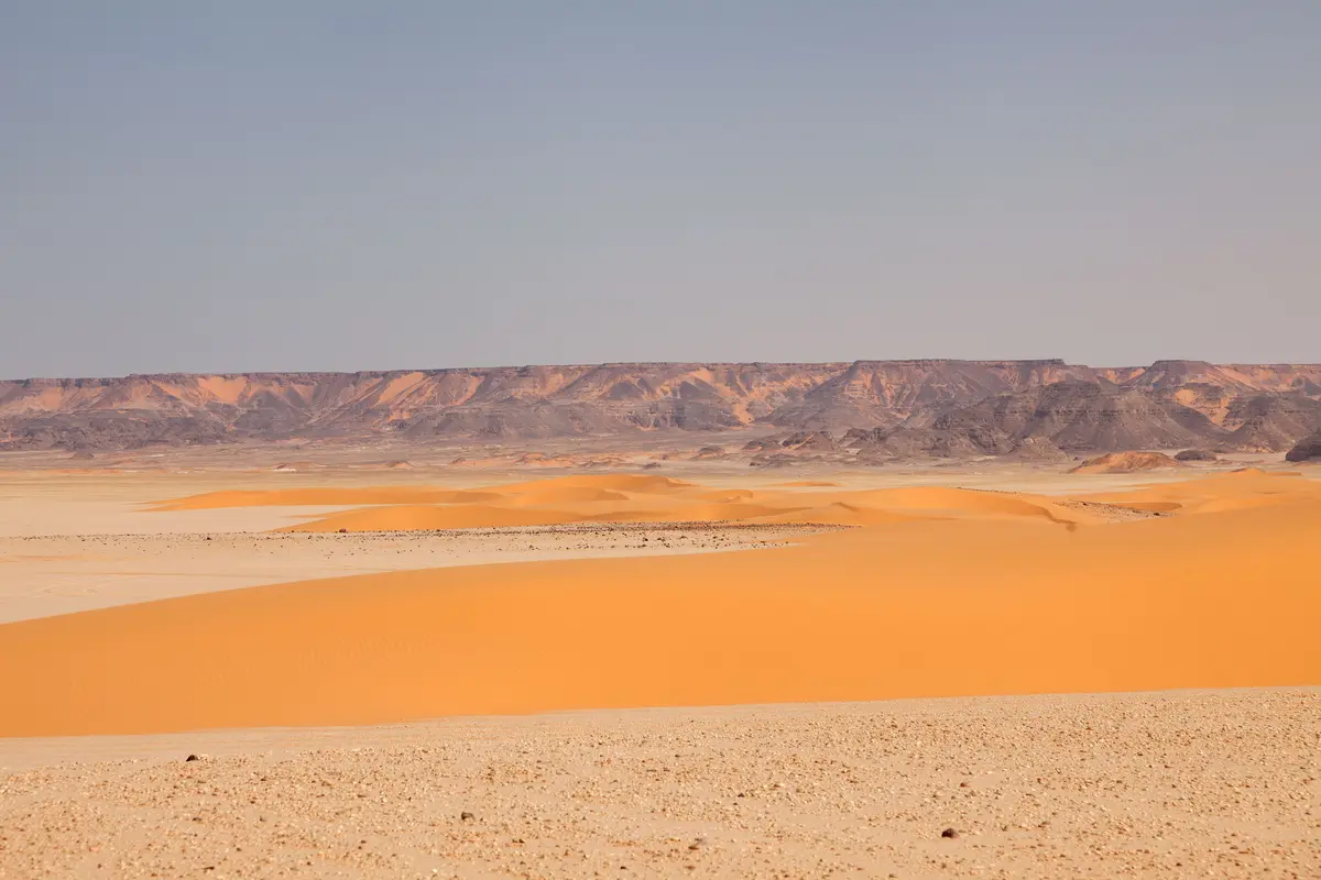
The Gilf Kebir is a sandstone plateau in the extreme south-west of Egypt near the borders with Libya and Sudan. It rises more than 300 metres above the desert floor and covers roughly 7,700 square kilometres. Penderel described it to the Royal Geographical Society in 1934 as lying some 450 miles west of the Nile [8]. It falls inside the Gilf Kebir National Park, created by Egyptian Prime Ministerial Decree No. 10 of 2007; the declaration press release gives the park 47,940 square kilometres while Egyptian government pages give about 48,523, so the figure is approximate [11].
Reaching it is a convoy expedition of a week or more out of Dakhla or Kharga, with a licensed operator carrying spare fuel and satellite communications, because the plateau has neither roads nor fuel nor phone coverage. The usual objectives are the rock art of Wadi Sura, including the Cave of Swimmers that Almásy found in October 1933, and Jebel Uweinat to the south. The Wadi Sura panels are painted and pecked directly onto open sandstone shelters, inside that protected area.
Permits are the hard part: the FCDO advises against all but essential travel to the area west of the Nile Valley and Delta, with named exceptions. It advises against all travel to within 20 km of the Egypt-Libya border, except the town of El Salloum, where the advice is against all but essential travel. It states that the south-west corner requires a permit from the Ministry of Interior because of its proximity to the borders with Sudan and Libya. The page was consulted on 10 September 2026 [12]. On 13 September 2015 a joint Egyptian police and army unit attacked a tourist convoy in the Western Desert and killed eight Mexican tourists and four Egyptians; the interior ministry said afterwards that the group should not have been in the area [13].
Sources consulted
- John Gardner Wilkinson, «Topography of Thebes, and General View of Egypt (pp. 358-359: the Wadee Zerzoora passage)» — John Murray, London, 1835 book
- John Gardner Wilkinson, «Modern Egypt and Thebes, vol. II (pp. 361-362: Zerzoora, with the added parenthesis on the stray camel)» — John Murray, London, 1843 book
- Ahmed Bey Kamal, «Livre des perles enfouies et du mystere precieux, vol. II (French translation, paragraph 369, 'La ville de Warde')» — Institut francais d'archeologie orientale, Cairo, 1907 book
- W. J. Harding King, «Lost Oases of the Libyan Desert (pp. 244-249)» — The Geographical Journal, vol. 72, no. 3, 1928 academic
- John Ball, «Remarks on 'Lost' Oases of the Libyan Desert (pp. 250-258; Zerzura at 252-255)» — The Geographical Journal, vol. 72, no. 3, 1928 academic
- E. A. Johnson Pasha, «Zerzura (pp. 59-61, in the section 'The Zerzura Problem')» — The Geographical Journal, vol. 75, no. 1, 1930 academic
- Richard A. Bermann, «Historic Problems of the Libyan Desert (pp. 456-462; paper read to the RGS on 8 January 1934)» — The Geographical Journal, vol. 83, no. 6, 1934 academic
- H. W. G. J. Penderel, «The Gilf Kebir (pp. 449-456; paper read to the RGS on 8 January 1934)» — The Geographical Journal, vol. 83, no. 6, 1934 academic
- J. F. McCauley, G. G. Schaber, C. S. Breed and others, «Subsurface Valleys and Geoarcheology of the Eastern Sahara Revealed by Shuttle Radar» — Science, vol. 218, no. 4576, pp. 1004-1020, 1982 academic
- Andras Zboray (FJ Expeditions), «The Zerzura Club: founding, members and dinners» — fjexpeditions.com, 2005 web
- Egyptian Environmental Affairs Agency / IUCN Mediterranean newsletter, «Declaration of the Gilf Kebir Protected Area (press release on Prime Ministerial Decree No. 10 of 2007)» — IUCN-Med newsletter, issue 24, 2007 report
- Foreign, Commonwealth and Development Office, «Egypt travel advice: regional risks (Western Desert, Libya border, permits)» — gov.uk, 2026 web
- Time staff, «Egyptian Forces Accidentally Kill a Group of Mexican Tourists» — Time, 2015 newspaper archive
Reviewed by V. Serrano on 2026-08-16 · How we verify our content
📎 Source: Enigma Atlas
💬 Field testimonies (0)
No testimonies yet. Add the first.
Add your testimony
🔒 Log in to add a testimony