👻 HAUNTED PLACE · EXP. Nº0482
ACTIVE
Menacuddle
Menacuddle is a location reputed to be haunted in Cornwall, GB. Its reputation comes from reported apparitions, unexplained phenomena and eyewitness accounts gathered over time.
Where is Menacuddle?
- Location
- Cornwall, GB
- Type
- Forest / nature
- Coordinates
- 50.346, -4.796
- Testimonies
- 0
- Last updated
LOCATION
Why is Menacuddle said to be haunted?
Menacuddle Well is a small granite well house built over a spring in a wooded valley on the northern edge of St Austell, Cornwall. It has been a scheduled ancient monument since 22 March 1932 and is also a Grade II* listed building. Historic England dates it to the late 15th century; the party from the Royal Institution of Cornwall who were shown round in 1875 were told it looked like the Late Decorated period, a century earlier. What the name means has never been settled, and at least five readings have reached print since 1824, from the belly or basin in the rock to the hawk's stone.
The oldest datable account of the place, in the History of Cornwall of 1824, describes a healing spring where weak children were bathed and ulcers washed, and a custom of throwing a crooked pin into the water for good luck through life, with the old pins said to rise from the bottom to meet it. The same page adds that nobody had ever seen it happen. The reputation of the surrounding wood for a large black animal rests on one named witness, a Cornwall councillor, warning a town council meeting in July 2015.
What is the history of Menacuddle?
Menacuddle Well stands in a wooded valley on the northern side of St Austell, in the Cornish parish of Treverbyn. Historic England first scheduled it on 22 March 1932 and amended the entry on 7 June 2000. The official list entry, NHLE 1019163, describes "a small granite building over a well basin", orientated east-west with the east wall built against the natural rock face, "constructed of large granite blocks and mortar, while the roof is also of large granite slabs supported on three massive ribs". It measures 2.3 m high by 2.74 m wide and 3.45 m long, with a pointed arched entrance in each of the north and south walls and a small rounded arched window in the west. The same entry records that the well house "is a Listed Building Grade II*" as well as a scheduled monument.
What the name means has never been settled, and the charity that now looks after the site says so in as many words: "Many local historians have attempted to decipher the meaning of this place-name but lack of records leaves it to conjecture." At least five readings have reached print. John Whitaker, quoted in the History of Cornwall of 1824, took the place to be "denominated Menacuddle in writing, or Menakettle in pronunciation; a Cornish appellation, that signifies merely the belly or basin in the rock". R. C. Hope printed "maen-a-coidl, the hawk's stone" in 1893. The Journal of the Royal Institution of Cornwall proposed in 1902 a derivation from Meen and Cuddigle, the cell or retreat of Meen. A. L. Rowse read it as the stone or rock wall. The version now repeated online, from Old Cornish mened and cuydel, hillside with a small wood, is credited by Wikipedia to page 122 of Craig Weatherhill's Placenames in Cornwall and Scilly (2005), a book not consulted here. It is the youngest of the five.
The medieval fabric is better attested than the name. M. and L. Quiller-Couch, working up their late father's notes for Ancient and Holy Wells of Cornwall in 1894, recorded that "At Menacuddle, and in the near neighbourhood of the well, was once a free chapel, subject to the Priory of Tywardreath", identified with the "free chapel of Benecuddle" in Dr Oliver's abridgment of the certificates of chantries, and founded by the ancestors of Peryse, the family later established at Penrice. Historic England dates the well house to "the late 15th century". The members of the Royal Institution of Cornwall who were shown round in 1875 were told something else: "Menacuddle Well or Baptistry, as it is sometimes called, is a low, rude granite structure with a ribbed roof, built over a natural spring of pure water. It appears to date from somewhere about the Late Decorated period." That would put it a century earlier.
The oldest datable description of what people did there is in the first volume of Fortescue Hitchins and Samuel Drew's History of Cornwall, published in 1824, at pages 633 and 634. Drew, whom the Quiller-Couches call "a native of St. Austell", wrote that "Weak children have frequently been carried thither to be bathed; ulcers have also been washed in its sacred water; and people in seasons of sickness have been recommended by the neighbouring matrons to drink of this salubrious fluid", the benefit being credited "rather from some mystical virtue attributed to the water for ages past, than from its natural qualities". Then the pins: "On approaching the margin, each visitor, if he hoped for good luck through life, was expected to throw a crooked pin into the water; and it was presumed that the other pins which had been deposited there by former devotees, might be seen rising from their beds to meet it before it reached the bottom."
The garden around the well is the work of Charles Rashleigh, the developer of Charlestown harbour. After his bankruptcy and death in 1823 the estate was bought by the Sawles of Penrice and the pleasure grounds leased to the Martin family, and it was a Martin who guided the 1875 excursion. Quiller-Couch found the well in 1894 "on the ornamental grounds of Mr. Martin, near St. Austell town", and found local usage divided between two names, since "Menacuddle estate is on one hill and Trethowel on the opposite, the well being in the valley between". The road that now runs above the well arrived with the Bodmin and Roche Turnpike Trust of 1836, terraced into the granite of the hillside; before that the way into the town ran along the valley floor, past the well itself.
The memorial the well carries has a name behind it. Lieutenant Richard Charles Graves-Sawle of the 2nd Battalion Coldstream Guards was, in the words of The Bond of Sacrifice, "the only son of Rear-Admiral Sir Charles Graves-Sawle, Bart., M.V.O., and Lady Graves-Sawle, of Penrice, Cornwall, and Barley, Exeter". His marriage to Muriel Heaton-Ellis "had been arranged to take place in October" and, "owing to the outbreak of war", took place instead on 6 August 1914. He sailed for France on 12 August, fought through the retirement from Mons, and was "killed at Ypres on the 2nd November, 1914", at twenty-six. In 1921 his father gave the baptistry and the grounds around it to the Parochial Church Council of Holy Trinity, St Austell; Historic England records that the well "was restored in 1922 as a memorial to a member of the Sawle family, owners of the Menacuddle Estate, who died in World War I". The ground passed from the church council to St Austell Rural District, then Restormel Borough, and is now owned by Cornwall Council.
Timeline: the documented record of Menacuddle
- 1824 Fortescue Hitchins and Samuel Drew print the oldest datable account of the well, describing the bathing of weak children, the washing of ulcers and the throwing of a crooked pin for good luck through life.
- 1836 The Bodmin and Roche Turnpike Trust begins the new road north out of St Austell, terraced into the hillside above the well; the old way into the town had run along the valley floor past it.
- 1875 Mr Martin, the tenant of the pleasure grounds, guides visiting members of the Royal Institution of Cornwall round the well, which their account dates to about the Late Decorated period.
- 1882 Fred W. P. Jago lists the site in his Cornish glossary under the name Pinni-menny, and gives the custom as fortune-telling by young people rather than as a wish.
- 1893 Robert Charles Hope reprints Drew's account almost verbatim, adds the phrase that stuck, that Menacuddle 'is also a wishing well', and offers a third etymology, the hawk's stone.
- 1894 M. and L. Quiller-Couch publish their chapter on the well, record that local usage was split between Menacuddle Well and Trethowel Well, and note the pins still lying in the granite basin.
- 2 November 1914 Lieutenant Richard Charles Graves-Sawle, only son of Rear-Admiral Sir Charles Graves-Sawle of Penrice, is killed at Ypres at twenty-six, twelve weeks after a wedding brought forward by the outbreak of war.
- 1921 Rear-Admiral Sir Charles Graves-Sawle gives the baptistry and its grounds to the Parochial Church Council of Holy Trinity, St Austell, in his son's memory.
- 1922 The well house is restored as the Sawle family memorial, the work Historic England still cites as the reason the monument survives so well.
- 22 March 1932 Menacuddle Well is scheduled as an ancient monument; the entry is amended on 7 June 2000 with the description and the note that it is also a Grade II* listed building.
- 29 July 2015 The St Austell Voice reports Cornwall councillor Sandra Heyward warning a town council meeting about a large black animal at the site, in response to a proposal to clear the overgrown grounds.
- 11 May 2016 A walker finds human remains in a slate coffin near the well; police attend and forensic experts conclude the burial is centuries old, which makes it an archaeological matter rather than a criminal one.
- 2016 The Friends of Menacuddle are set up as a community charity, clearing invasive laurel with a Tesco grant and repointing the well house in lime and sand on Historic England's advice.
Is there a rational explanation for Menacuddle?
The reputation of the wood rests on one named witness speaking on one recorded occasion. On 29 July 2015 the St Austell Voice reported that Sandra Heyward, Cornwall councillor for Gover and a St Austell town councillor, had warned a council meeting about the site, which the former town councillor Wendy Earl had just proposed clearing of laurel: "It's a very special place. It's an important site and I welcome the work. But be careful clearing the trees as there is a large black animal. I have got to be careful what I say, living up there. It is not a dog, it's not a cat. I have seen it." Neither a carcass nor a photograph nor a hair sample has been produced before or since, and the warning was addressed to volunteers about to cut back undergrowth. An earlier version of this file spoke of numerous sightings and of unverified reports held in Devon and Cornwall police files; no source for either statement could be located, and both have gone.
The human remains found in the wood belong to a separate and older story than the file used to tell. The Daily Express reported on 11 May 2016 that a walker had found a skull while exploring "a cave which includes a spring dating back thousands of years", that he called the police and that a forensics team attended, and that "experts believe the body has remained in the woods for hundreds of years". Councillor Heyward, quoted again, said the body lay in a slate coffin: "There was a time when they buried people in slate coffins for a particular reason in the 1700s to 1800s." An earlier version of this file called the find a criminal investigation. The contemporary report describes an archaeological one.
The pin custom has a shape that can be dated, and it has drifted. Drew closed his 1824 account with a failure rather than a wonder: "And though many have gazed with eager expectation, no one has yet been permitted to witness the traditionary phenomenon." Fred W. P. Jago recorded a different purpose under a different name in 1882, listing the site in his Cornish glossary as Pinni-menny: "Young people wanting to know their fortune, dropped pins into the well and 'wished.'" On the same page Jago reprinted Bernard Quaritch flatly contradicting both readings: "There is ample proof that the pin is not a mere offering to the spirit of the well, such as a rag, a pebble, or a small coin might be, but is flung in by way of curse, to injure the person who is present in the mind at the time the pin is thrown in." R. C. Hope, reprinting Drew almost word for word in 1893, added the label that stuck, "It is also a wishing well", and turned Drew's "traditionary phenomenon" into "this extraordinary phenomenon". The scheduling entry amended in 2000 has bent pins thrown "for good luck". The formula now repeated online, that the wish is granted, is the youngest layer of all.
Menacuddle is absent from the two Victorian collections that would be expected to carry it. The full text of Robert Hunt's Popular Romances of the West of England (1865) contains no occurrence of the name and none of "crooked pin" or "bent pin", against 376 occurrences of the word "well" and five of "St. Austell" in the same file; William Bottrell's Traditions and Hearthside Stories of West Cornwall (1873) likewise contains none, against 211 occurrences of "well" and one of "Austell". Both counts were run on 7 September 2026 over the Internet Archive plain-text scans, with flexible spacing to allow for the doubled spaces the optical character recognition leaves behind. An earlier version of this file credited the Menacuddle pin custom to Hunt and Bottrell as collectors; neither of them mentions the place.
The organisation that maintains the site is silent on all of it, and has no takings to protect. Across the ten pages of the Friends of Menacuddle website, about 2,700 words read on 7 September 2026, the words ghost, beast, haunted and spirit appear no times at all, against twenty-five occurrences of "well", nine of "Sawle" and five of "Rashleigh"; what the pages describe is lime mortar, invasive laurel and a dredged pond. Entry is free, and nobody sells a tour of the wood. The Quiller-Couches, who were there in 1894, had already put the custom in the past tense, describing Cornish superstition as something that "lurks in their minds, and betrays itself in the wearing of a secret charm, or the half-playful dropping of a pin into the well by the sentimental maiden".
Can you visit Menacuddle?
Menacuddle Well stands beside Bodmin Road on the northern edge of St Austell, in the parish of Treverbyn. OpenStreetMap gives the postcode as PL25 5AG and places the well house at 50.34557, -4.79566; the scheduling entry gives the national grid reference SX 01187 53253, which converts to a point 2 m away. Drew in 1824 put it "About half a mile from St. Austell", and Whitaker, quoted in the same volume, "a quarter of a mile to the north of the town". Historic England places it "in an ornamental garden in a valley running north from St Austell", which is worth stating plainly, because directions putting the well on the south side of the town have circulated, this file included.
The ground belongs to Cornwall Council. There is no gate and no charge, the site has neither a car park nor a visitor centre, and the well house is reached on foot down a short path from the road; the list entry notes that "the modern surface of the gravel footpath to the north, south and west of the well is excluded from the scheduling, where it falls within the monument's 2m protective margin". The walk up the valley from the town centre is closed: the Friends of Menacuddle state that the lower part of the valley "is owned by St Austell Brewery and is not currently open to the public but hopes are that ultimately the full walk from town will be restored".
The Friends, a community charity formed in 2016, run open working days on the site: "We hold a 'Welly Day' on the second Sunday of every month, 2:00pm to 4:00pm to work on the site and we are always pleased to welcome volunteers." Their website was read on 7 September 2026; the most recent entry on its news page is a Wellie Day report from March 2020, and the site carries a contact page.
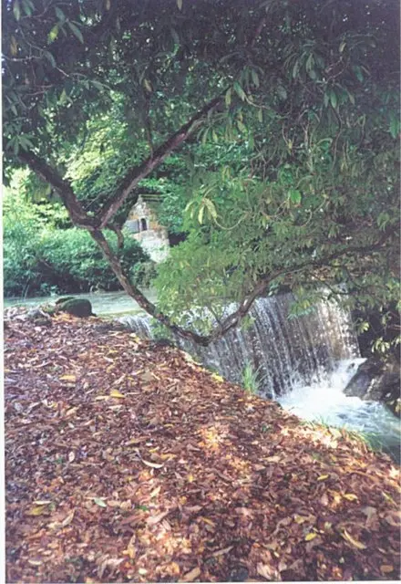
The well house is protected twice over, as a scheduled monument and, in the words of the list entry, as "a Listed Building Grade II*". Damaging a scheduled monument is an offence under the Ancient Monuments and Archaeological Areas Act 1979. The Friends describe replacing concrete mortar on the walls and roof with lime and sand on Historic England's advice, sealing the iron window bar against rust and renewing the fixings of the information plaque. BBC Cornwall described the place in July 2009 as "a little known beauty spot which houses the historic Menacuddle Well, surrounded by trees and rhododendron bushes"; that page has since been archived and carries the line "last updated: 29/07/2009". The photograph on this file was taken by Michael Murray and captioned, on Geograph, "This is in a beautiful secluded place next to a main road,very quiet and peaceful".
Sources consulted
- Fortescue Hitchins and Samuel Drew, «The History of Cornwall, from the Earliest Records and Traditions, to the Present Time, vol. I (pp. 633-634)» — William Penaluna, Helston, 1824 book
- Robert Hunt, «Popular Romances of the West of England, or, The Drolls, Traditions, and Superstitions of Old Cornwall» — John Camden Hotten, London, 1865 book
- Fred W. P. Jago, «The Ancient Language and the Dialect of Cornwall (entry 'Pinni-menny', pp. 234-235)» — Netherton and Worth, Truro, 1882 book
- Robert Charles Hope, «The Legendary Lore of the Holy Wells of England (St Austell: Menacuddle Well, pp. 21-22)» — Elliot Stock, London, 1893 book
- M. and L. Quiller-Couch, «Ancient and Holy Wells of Cornwall (Menacuddle Well, pp. 156-159)» — Chas. J. Clark, London, 1894 book
- L. A. Clutterbuck (ed.), «The Bond of Sacrifice: A Biographical Record of All British Officers Who Fell in the Great War, vol. I (Lieutenant Richard Charles Graves-Sawle)» — The Anglo-African Publishing Contractors, London, 1917 book
- Historic England, «Menacuddle Well, Treverbyn: official list entry, scheduled monument NHLE 1019163» — National Heritage List for England, 2024 report
- Natasha Swift, «'Beast' spotted at holy well» — St Austell Voice, 2015 newspaper archive
- Joey Millar, «Walker finds HUMAN REMAINS in eerie wood haunted by BLACK BEAST» — Daily Express, 2016 newspaper archive
- Friends of Menacuddle, «Menacuddle Well and Gardens: history, Friends of Menacuddle and Wellie Days» — Friends of Menacuddle, 2026 web
- BBC Cornwall, «St Austell Walk» — BBC Local: Cornwall History, 2009 web
Reviewed by V. Serrano on 2026-09-07 · How we verify our content
📎 Source: Wikipedia (CC BY-SA)
💬 Field testimonies (0)
No testimonies yet. Add the first.
Add your testimony
🔒 Log in to add a testimony