👻 HAUNTED PLACE · EXP. Nº0482
ACTIVE
Paulding Light
Paulding Light is a location reputed to be haunted in Michigan, US. Its reputation comes from reported apparitions, unexplained phenomena and eyewitness accounts gathered over time.
Where is Paulding Light?
- Location
- Michigan, US
- Type
- Forest / nature
- Coordinates
- 46.352, -89.179
- Testimonies
- 0
- Last updated
LOCATION
Why is Paulding Light said to be haunted?
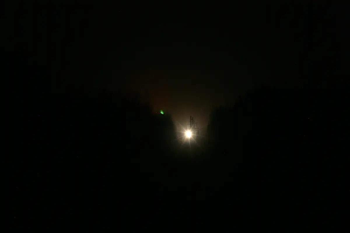
Robbins Pond Road, a gravel dead end in the Ottawa National Forest of Michigan's Upper Peninsula, is not a forest track: it is the stretch of US-45 that was bypassed in 1957, when the highway was rebuilt to the east. Almost every clear night a light appears at the far end of the valley it overlooks, above the treeline, along a corridor cleared for power poles. Witnesses describe it brightening, flickering, sometimes splitting in two or three, and fading after a minute or so. The place is also known as Dog Meadow. The first recorded sighting dates from 1966, when a group of high-school boys reported it to the local sheriff; the best-known legend makes it the swaying lantern of a railway brakeman killed on the line, though no account names him or dates the accident. In 2010 a student team from Michigan Technological University identified it through a telescope as the headlights of vehicles on the present US-45, several miles away, and then produced it on demand by driving that stretch themselves. The viewing point is free and unstaffed, the Forest Service signs it only seasonally, and it still fills with cars on summer nights. Many visitors leave unconvinced.
What is the history of Paulding Light?
The first thing to understand about the Paulding Light is that the place you watch it from is not a forest track. It is a highway — or rather the corpse of one.
Between 1954 and 1958 the Michigan State Highway Department rebuilt US-45 from Watersmeet northwards into Ontonagon County. The northern phase of that project began about four miles south of Paulding and carried the new road east of the old one for some three and a half miles before swinging back to rejoin the existing route through the village. It opened to traffic at the end of 1957; the 5.7-mile stretch it replaced was struck off the trunkline register and handed back to the county. That abandoned segment is today's Robbins Pond Road, and its dead end is the viewing area. Michigan's own route history is blunt about the coincidence: "The portion of Old US-45 bypassed during 1957 happens to be the location of the fabled 'Paulding Light' phenomenon."
So the geometry that everybody comes to look at is nine years younger than the first report. On one side of the valley, a gravel road going nowhere, blocked by a guardrail. On the other, over the treeline, a stretch of the new highway climbing a hill. Between them, a corridor cleared for power poles, and a recreation trail that snakes down and up again along the old grade.
The older name for the spot is Dog Meadow, and the Free Press notes that the road "used to lead straight to Paulding". The first recorded sighting is dated 1966, when — as John Carlisle put it in the Detroit Free Press in September 2016 — "a group of high school boys reportedly saw it and told the local sheriff". Everything before that is oral: residents insist the light is far older, and some tie it to a period long before there were roads at all.
The legend, and what holds it up. The version Carlisle calls "the official legend" is specific: the light is "the swaying lantern held by the ghost of a railroad brakeman who died when he was crushed as he tried to stop an oncoming train from hitting railcars stalled on the tracks". Linda Godfrey, writing in Weird Michigan, gives a looser form of the same idea — "the ghostly lantern of an old railroad worker killed on the job who still shows up faithfully to light the way", the swinging of the lantern accounting for the pendulum motion witnesses describe. Carlisle also collected the competitors: some say it is the headlamp of the ghost train itself; some "the distraught spirit of a grandparent looking for a lost grandchild with a lantern that needs constant relighting"; others swamp gas, the northern lights, or something extraterrestrial. William Kingsley, whose account Godfrey reproduces, notes that of the hundred-odd "ghost lights" catalogued in the United States, several carry the identical railway-worker story, and others a tale of lovers who killed themselves because they could not marry.
That is a legend without a name, a date or a document. Nobody in any account we could read identifies the brakeman, the train, the year or the coroner. What is documented is the railway itself, and it deserves saying plainly, because the usual sceptical shortcut — "there was never a railroad there" — is not what the record shows. Paulding was a real station stop, on the Chicago & North Western's Choate Branch north of Watersmeet. The line that became it was begun in August 1886 by the Milwaukee, Lake Shore & Western to tap the Diamond Match Company's camps on the Ontonagon River; contemporary reporting expected it to reach Ontonagon by that October. It never did. Watersmeet itself grew up around a C&NW junction with a yard, a turntable, a wye and a seven-stall roundhouse. Trains, brakemen and lanterns were entirely at home in this valley. Only the accident is missing from the paper.
The witnesses. The best-documented early sighting belongs to William Kingsley, a writer and researcher from Mt. Pleasant, who first came across the light by accident: the placemat in a Watersmeet restaurant carried a county map with "a mysterious light" listed among the local attractions. He returned in May 1980 with a 35 mm camera, ASA 400 film, a tripod and a shutter release, and parked with other waiting cars on a Forest Service road. His description is careful and worth quoting because it is not a ghost story: "It was amber, glowing to a white light", on for about a minute at a time, roughly 150 yards away, apparently suspended in the air. "It flickered and swayed; its light reflected off the power lines and my jacket." Once it seemed to split in two — and the negative, he says, bore this out, showing two dark spots one above the other. Afterwards he watched smaller red lights drift and arc above the pines.
By the time Weird Michigan went to the site, in July of the mid-2000s, the ritual was fully formed: cars lining the gravel, about forty people of every age waiting at the guardrail, children in pyjamas running about, somebody shouting that a bear was crossing the road. Then the light: "It could have been headlights. But then it flared brighter, and turned bright red. Would headlights do that?"
The crowds grew until the US Forest Service put up a sign in the middle of the woods at the end of the road, marking the place to see the famous Paulding Light and adding, in Carlisle's paraphrase, a polite request: "Please do not litter." Jason Lannet, who in 2016 owned the Paulding General Store at the village's only intersection, told the Free Press: "I've seen it where there's 50 cars there, both sides of the road and all the way back. I get a million people that come looking for directions because they're lost."
Timeline: the documented record of Paulding Light
- August 1886 The Milwaukee, Lake Shore & Western pushes a branch north from Watersmeet to reach the Diamond Match Company's camps on the Ontonagon River; the press expects it to reach Ontonagon by October. It never does. Paulding becomes a station stop on what ends up as the Chicago & North Western's Choate Branch.
- End of 1957 The relocated US-45 opens to traffic east of the old route south of Paulding. The 5.7-mile stretch it replaces is struck off the trunkline register and becomes Robbins Pond Road. Michigan's route history notes that this bypassed segment "happens to be the location of the fabled 'Paulding Light' phenomenon".
- 1966 The first recorded sighting: a group of high-school boys report the light to the local sheriff. Nine years have passed since the new highway opened. Everything earlier is oral tradition.
- May 1980 William Kingsley photographs the light from a Forest Service road with a 35 mm camera on a tripod, ASA 400 film and a cable release. "It was amber, glowing to a white light", on for about a minute at a time, some 150 yards off. When it appeared to split in two, he says the negative showed two dark spots, one above the other.
- 2006 — the ritual Linda Godfrey publishes her own night at the guardrail in Weird Michigan: cars lining the gravel, some forty people of all ages, children in pyjamas, a bear crossing the road. Then the light: "It could have been headlights. But then it flared brighter, and turned bright red."
- May 2010 Jeremy Bos, a PhD candidate in electrical engineering, proposes the Paulding Light as a project for Michigan Tech's student chapter of SPIE, the optics and photonics society. About a dozen students join him. It is a teaching and outreach exercise, not a funded study.
- 28 October 2010 Michigan Tech announces the result. Through a telescope the students see headlights; an Adopt-a-Highway sign lets them locate the exact stretch of US-45 on Google Maps; Bill Norkus logs passing vehicles there while the rest log appearances, and every appearance matches a car. Then they generate the light themselves: "Bill put on his hazards, and we saw flashing yellow lights."
- 4 September 2016 The Detroit Free Press finds the crowds undiminished six years after the debunking. Terry Nestle, watching: "That's pretty long lights for a car. That's a long-lasting light. That's not a car topping a hill." Bos: "There is scientific evidence to disprove all sorts of things, and people still choose to believe the more fantastical."
- July–October 2017 WAG TV films a re-creation of the 2010 investigation at Paulding for the Science Channel series Strange Evidence. Bos, by then an assistant professor, describes hot and cold air sandwiched into an "optical duct", and warns that in total darkness autokinesis makes a fixed point of light appear to move.
Is there a rational explanation for Paulding Light?
This is one of the very few famous "mystery lights" anywhere with an explanation that was not merely proposed but produced on demand in front of witnesses. It is also routinely described in ways the researchers themselves never claimed, so it is worth separating the demonstration from the hypothesis.
Who did it. Not a physics club. In May 2010 Jeremy Bos, then a PhD candidate in electrical engineering at Michigan Technological University, was looking for a project for the university's student chapter of SPIE, the professional society for optics and photonics. About a dozen students joined him. The team member named in the press release is Bill Norkus; undergraduates Doug Sims and Mike Mauer also contributed, and the project advisors were Christopher Middlebrook and Michael Roggemann of the Department of Electrical and Computer Engineering. Bos had first seen the light himself in 1997.
What they actually demonstrated. Three things, in ascending order of force.
First, they looked. On the second trip they brought a telescope, the light appeared, and through the scope they saw headlights on a car travelling down a highway — sometimes, Carlisle reports, with the outline of the vehicle visible. This much had been claimed before: Bos says flatly, "We're not the first people who have come to this conclusion. A paranormal investigation team came here in the 1980s and showed it was headlights." He does not name that team and we could not identify it.
Second, they located the source and tested the correlation. Through the telescope they picked out an Adopt-a-Highway sign — not, as is often repeated, a licence plate — and tracked the exact stretch down on Google Maps. Norkus was then sent to stand at that spot on US-45 and log every vehicle that passed, while the rest of the team stayed on Robbins Pond Road logging every appearance of the light. "Sure enough, every time the Paulding Light appeared, a car drove by the spot."
Third — and this is the part that makes the case unusual — they made the light happen. A SPIE member drove his own vehicle along that stretch of US-45, and its passage matched the appearances exactly. "Bill put on his hazards, and we saw flashing yellow lights," Bos said. A phenomenon you can switch on and off from four and a half miles away with a hazard-light stalk is not much of a phenomenon.
What they did not demonstrate, at least not on the record. The October 2010 release is explicit that the spectrograph work was still to come: "The students will also use a spectrograph to characterize the light from both the headlights and the Paulding Light. Based on the evidence so far, they expect them to be identical." Michigan Tech's 2017 follow-up says a spectrograph was used, but no data or paper is given. The students planned to present at an SPIE meeting; we could find no peer-reviewed publication on the Paulding Light by Bos or the chapter. This was an outreach and teaching project, announced in a university press release and later re-staged for television — sound work, but not a paper, and it should not be cited as one.
The atmospheric part is a hypothesis, not a measurement. Popular accounts say the students "proved the light is a mirage caused by a temperature inversion". The original text is far more careful: heat rising off the pavement "may sometimes contribute to the light's distortion", and an inversion layer in the line of sight "may also create very stable air, which could account for the light's visibility" at that range. In 2017 Bos described the mechanism as sandwiched hot and cold air creating an "optical duct", and noted the practical consequence: "The most interesting atmospheric effects happen near sundown, and unless it's warm and sunny during the day the fall is not as interesting as late spring." The refraction explains why the headlights carry so far, not that they are headlights; the latter was settled by the telescope and the hazard lights.
Even the distance is not agreed. Michigan Tech puts the source stretch of US-45 about four and a half miles from the viewing area, and repeated the figure in 2017. The Detroit Free Press, reporting the same investigation, wrote that the road is "about 8 miles away". We could not reconcile the two.
The behaviour people find impossible. Movement: Bos attributes it partly to the terrain — that section of US-45 runs over a hill, so lights rise, fall and stop as vehicles crest it, and change in intensity as drivers dip and raise their beams — and partly to autokinesis, the well-documented illusion in which a fixed point of light in an otherwise featureless dark field appears to drift. That, he notes, is why midnight is scientifically the least interesting hour and psychologically the most convincing one. The spectacular multicoloured displays he does not claim to have explained: "I think that the occasional spectacular lights happen when a cop pulls someone over" is offered, in his own words, as a guess.
The objections, stated fairly. Terry Nestle, watching in 2016, was unpersuaded on duration: "That's pretty long lights for a car. That's a long-lasting light. That's not a car topping a hill." Linda Schulz, owner of the Running Bear Resort, made the historical objection: "Long before roads were even involved, this light is in some of the history that is in the area. Even in the Native American history they talk about the light, and this is long before there were roads." Kingsley was told locally that the light predated the power lines. We found no documentary support for either claim, and both are hard to test — but the timing evidence runs the other way, and it is concrete: the viewing road was bypassed and the new alignment opened in 1957; the first reported sighting is 1966. That is a nine-year gap, which is a weaker version of the argument than the usual "the reports started the moment the highway opened", but it still puts the sightline first and the legend second.
Why it survives. Bos has been out there fifteen times, "hours at a time, in the heat, the cold, and the rain. It's always the same. We were there Monday with a man who saw the headlights on our computer, and he refused to believe it." Adam Feltz, a psychologist at Michigan Tech, framed it as motivated reasoning: "it's hard to change a belief, especially when one is invested in that belief emotionally", and belief can supply a sense of being special, a way of making sense of the world, and membership of a group. Bos's own summary is shorter: "No matter what, some people will believe what they want to believe." A friend asked whether he planned to disprove Santa Claus next.
Can you visit Paulding Light?
The viewing area is public land in the Ottawa National Forest, with no admission charge and no opening hours.
Where it is. The dead end of Robbins Pond Road, Ontonagon County, at roughly 46.352° N, 89.179° W. The road is the remnant of old US-45 — gravel, closed by a guardrail about half a mile in. It lies about four miles south of the hamlet of Paulding and about five miles north of Watersmeet, on the western Upper Peninsula.
Getting there. Robbins Pond Road leaves US-45 between Watersmeet and Bruce Crossing. Coming north out of Watersmeet the turning is on the left after roughly five miles; coming south from Bruce Crossing it is on the right, past Sleepy Hollow Road and Memory Lane. The Detroit Free Press describes that turning as unmarked, and Michigan Tech notes that the Forest Service sign is seasonal and comes down out of season; the national forest campground sign is the one that stays up all year. The surface is loose sand and gravel with the forest closing in on it, and the last few metres from the barrier are on foot.
Where to look. From the guardrail the ground drops into a wooded valley, and a line of power poles and a recreation trail run down the old highway grade and back up the far side towards Paulding. The light appears over the notch in the treeline at the top. Under magnification the Michigan Tech students resolved it into headlights and tail lights; vehicle outlines and a roadside sign stood behind them. Binoculars or a small telescope change what the viewing area shows.
When to go. Bos's advice is specific and rarely followed: "The most interesting atmospheric effects happen near sundown, and unless it's warm and sunny during the day the fall is not as interesting as late spring." Midnight is the classic hour and the one he calls scientifically least interesting, although it is when autokinesis makes the light look most alive.
The time zone changes on the way. Under 49 CFR 71.5 the boundary between the Eastern and Central zones follows the county line here. Watersmeet, in Gogebic County, keeps Central time; Paulding and the viewing area, in Ontonagon County, keep Eastern time. A phone can jump an hour on a fifteen-minute drive, and a sunset worked out in the wrong zone is an hour out.
Facilities. Nothing is charged and nothing is provided. The barrier has no gate to close, and the site has no lighting, toilets or drinking water. Phone coverage in the valley is patchy at best. Michigan Tech's 2017 visit found spent fireworks and beer cans at the barrier along with cigarette ends, and the Forest Service sign has for years asked visitors not to litter.
Practical warnings. Mosquitoes are ferocious on summer nights, and the Free Press watched a group driven half mad by them. This is black bear country: Weird Michigan records one crossing the road in front of forty waiting spectators. Beyond the barrier the corridor is a working ORV and snowmobile trail rather than a footpath, and the old bridge down the valley washed out decades ago. On summer weekends the Free Press counted up to fifty cars parked on both sides all the way back.
Nearby. Paulding is a single crossroads with a general store. At the time of the Free Press's 2016 visit the Running Bear Resort was renting small cabins to hunters and anglers and also to snowmobilers and light-hunters, each cabin holding a ledger of guests' accounts. Bond Falls is a short drive away from there. The Watersmeet/Iron River Ranger District office is at E23979 US 2 East, Watersmeet, MI 49969, telephone 906-358-4551; Forest Service snapshots of October 2025 and April 2026 both give its hours as Monday to Friday, 08:00 to 16:00 Central.
Sources consulted
- Marcia Goodrich, «Just in Time for Halloween: Michigan Tech Students Solve the Mystery of the Paulding Light — the SPIE student chapter investigation, the telescope, the Adopt-a-Highway sign, Bill Norkus's vehicle log, the hazard-light reproduction and the hedged atmospheric hypothesis» — Michigan Tech News, Michigan Technological University, 2010 report
- Cyndi Perkins, «It's Out There: Return to the Paulding Light — the 2017 Science Channel re-creation, Bos on the optical duct and autokinesis, the seasonal Forest Service sign, and directions to Robbins Pond Road» — Michigan Tech News, Michigan Technological University, 2017 report
- John Carlisle, «Mysterious light draws thrill seekers to a U.P. forest — the 1966 first report to the sheriff, the brakeman legend and its rivals, the Forest Service sign, and named witnesses (archived copy of the Detroit Free Press column)» — Detroit Free Press, 4 September 2016; Internet Archive Wayback Machine, 2016 newspaper archive
- Linda S. Godfrey, «The Paulding Light — excerpts from Weird Michigan (Weird U.S. series, Sterling Publishing, 2006), including William Kingsley's May 1980 photographic session and the author's own night at the viewing area, reproduced by permission» — Michigan BLUE Magazine, 1 October 2015; original: Weird Michigan, Sterling Publishing, 2006, 2006 book
- United States Department of Transportation, «49 CFR § 71.5 — Boundary line between eastern and central zones: the boundary follows the north line of Gogebic County, placing Watersmeet on Central time and Ontonagon County on Eastern time» — Code of Federal Regulations, Title 49, Part 71 (eCFR), 2013 report
- Michigan Railroad History (RRHX), «Paulding, MI — "Paulding was a station stop on the C&NW Choate Branch, north of Watersmeet"» — michiganrailroads.com, 2026 web
- Michigan Railroad History (RRHX), «Watersmeet, MI — the C&NW junction, yard, turntable, wye and seven-stall roundhouse, and the August 1886 branch north towards the Diamond Match camps that was never completed to Ontonagon» — michiganrailroads.com, 2026 web
- Christopher J. Bessert, «US-45 route listing — the 1954-58 modernisation between Watersmeet and Paulding, the northern phase opened at the end of 1957, and the note that the bypassed segment of Old US-45 is the site of the Paulding Light» — Michigan Highways (michiganhighways.org), 2024 web
- USDA Forest Service, «Watersmeet/Iron River Ranger District, Ottawa National Forest — address, hours and telephone (archived snapshot of the Forest Service page, which blocks direct requests)» — fs.usda.gov; Internet Archive Wayback Machine, snapshot of 4 October 2025, 2025 web
Reviewed by V. Serrano on 2026-08-01 · How we verify our content
📎 Source: Wikipedia (CC BY-SA)
💬 Field testimonies (0)
No testimonies yet. Add the first.
Add your testimony
🔒 Log in to add a testimony